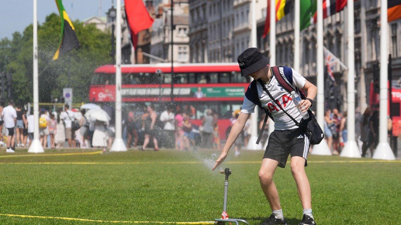

Temperatures have been rising and will continue to do so with the fourth heatwave of the summer on the way for some.
The UK Health Security Agency has issued heat health alerts, for all of England - beginning on Tuesday morning and lasting until Wednesday.
On Monday, five areas of England had their health alerts upgraded from yellow to amber - meaning there could be travel disruption or increased demand on health services.
The hottest weather will be focused in central and southern England, where temperatures are expected to exceed the official heatwave criteria for at least three consecutive days with a peak of 34C (93F) possible on Tuesday.
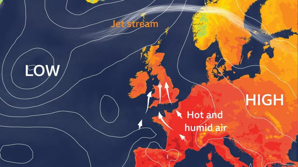
As high pressure dominates across central Europe, extreme heat has already been building in paces including Spain, Portugal and France. The French city of Nimes recorded its highest ever August temperature on Sunday of 41.8C (107F). Red extreme heat warnings in south-west France remain in place through Monday and Tuesday.
Some of that hot and humid air to our south will gradually spread north across the UK over the coming days.
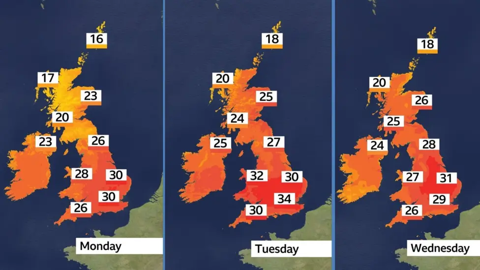
On Monday, many parts of England and Wales will see temperatures in the mid to high 20s. The London area is forecast to be around 30C whilst Scotland and Northern Ireland will remain a little cooler with highs in the low 20s.
By Tuesday, the warmth will become more intense and widespread as the heatwave reaches its peak.
Most of the UK will record temperatures between 24 and 30C, with the hottest conditions again focused on London and the Midlands which could reach 34C (93F). It's not currently expected to beat the UK's hottest day of 2025, which so far stands at 35.8C (96F) recorded on 1st July in Faversham, Kent.
Wednesday will be another hot day for many, but probably not quite as hot as Tuesday, due to a small shift in wind direction. Heatwave criteria is likely to hold on across central and eastern parts of England, east Wales and eastern Scotland.
Yellow heat health alerts will be in place for the whole of England from Tuesday morning until Wednesday evening, with amber alerts in place for London, the South East, East of England, East Midlands and West Midlands
As well as heat by day, the nights will also feel hot and humid for the first half of the week. There is a chance of a tropical night or two in southern England, where temperatures don't fall below 20C all night.
By Thursday and Friday, whilst most places will see temperatures in the low to mid 20s, we could record further heatwave days in southern England.
It currently looks likely that temperatures for most areas will fall slightly below heatwave criteria by the weekend, but after a brief slightly cooler interlude, it's high pressure that will build again through next week. This would mean an often dry and warm theme continuing for at least the next 10 days. Spells of cooler and wetter weather are likely at times, especially in the north and west.
Whilst temperatures are expected to drop a little through next week, they will still be above average for many, especially in the south. Average maximum temperatures in mid-August range between 16 to 22C north to south, but there are chances of strong heat developing again in places, particularly in the south.
You can always check the latest long-range forecast for the rest of the summer by taking a look at our monthly outlook.
As drought and hosepipe bans continue for several parts of England, many people will be hoping for some rain to accompany the heat, and there is some in the forecast, but it's going to be showery in nature so very hit and miss in terms of where it will fall.
Monday will bring a little patchy rain to Scotland and Northern Ireland during the day, with a few isolated showers in southern England and Wales overnight.
Showers look to become more widespread and thundery late on Wednesday and overnight into Thursday, especially for central and eastern England as well as Scotland. However, as is the nature with showers, many places will miss them altogether.
You can check the forecast details for your local area by downloading the BBC Weather App.

20 PerFlyer