
Hurricane Gabrielle is forecast to hit the central Azores early on Friday morning with red weather warnings in force for torrential rain, damaging wind gusts and enormous waves.
The President of the Government of the Azores, José Manuel Bolieiro has ordered the closure of public services ahead of the storm arrival saying "The absolute priority is to protect people's lives and safety."
According to the Portuguese forecasting authority IPMA (Instituto do Mar e da Atmosfera), wind gusts will reach up to 80mph (130km/h). Winds this strong are likely to blow trees down, threatening disruption to power and transport. Enormous waves are expected to bring dangerous coastal conditions with wave heights expected to reach 14-18 metres - the height of three stacked double-decker buses.
Up to 125mm (5 inches) of rain is likely according to NOAA's National Hurricane Centre leading to areas of flooding and possibly triggering some landslides in the mountains.

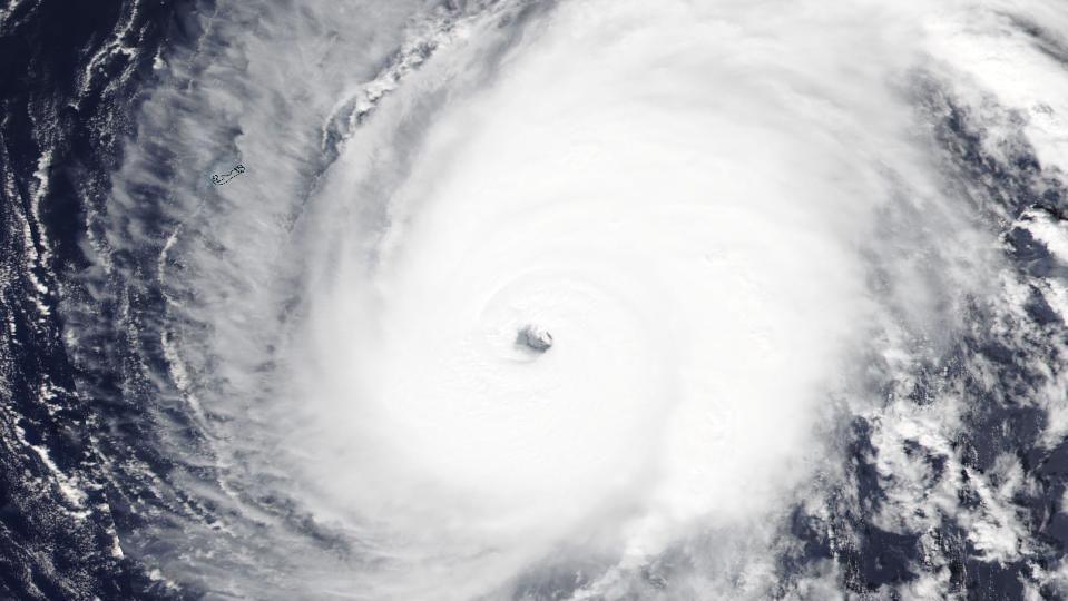
Gabrielle is only the second major hurricane of the Atlantic season, reaching its peak strength of 140mph as a Category 4 hurricane on Monday. It underwent a rapid intensification as it moved across unusually warm ocean waters in the eastern tropical Atlantic, widely 2C above average.
Over recent hours the hurricane has been interacting with an Atlantic weather front - the same front that will bring rain to the UK on Saturday. This has caused the speed that Gabrielle is moving forwards to accelerate to 32mph which is quite rapid for a hurricane.
It will also help the storm undergo its extratropical transition from a hurricane to a normal area of low pressure. This happens when a hurricane switches its power source from warm ocean water and instead starts to extract energy from the temperature differences found in the atmosphere.
It is rare for hurricanes to reach the Azores - but not unprecedented. The archipelago lies outside the region of warm tropical water which acts as their fuel.
The last hurricane to hit was Hurricane Gordon in 2012. It is much more common for tropical storms or hurricanes to reach the Azores as low pressures after they have gone through their extratropical transition. This happens most years.
The remnants of Gabrielle will reach the mainland of Portugal by the weekend bringing some wet and windy weather, but the low pressure will be much weaker by then.
We're also monitoring thunderstorms near Haiti and the Dominican Republic that could develop into a tropical storm or hurricane over the next few days. If formed, this may then move across the Bahamas before hitting South Carolina or Georgia in the US around Tuesday night bringing large falls of rain and some flooding.

On the other side of the world, the western Pacific is seeing some intense activity at the moment. Following the damage and destruction left by Typhoon Ragasa over recent days, another typhoon is on the way.
Typhoon Bualoi will move across the Philippines over the next 36hrs and will bring another round of damaging wind and flooding rain. It will make further landfalls in southern China and northern Vietnam over the weekend and early next week.