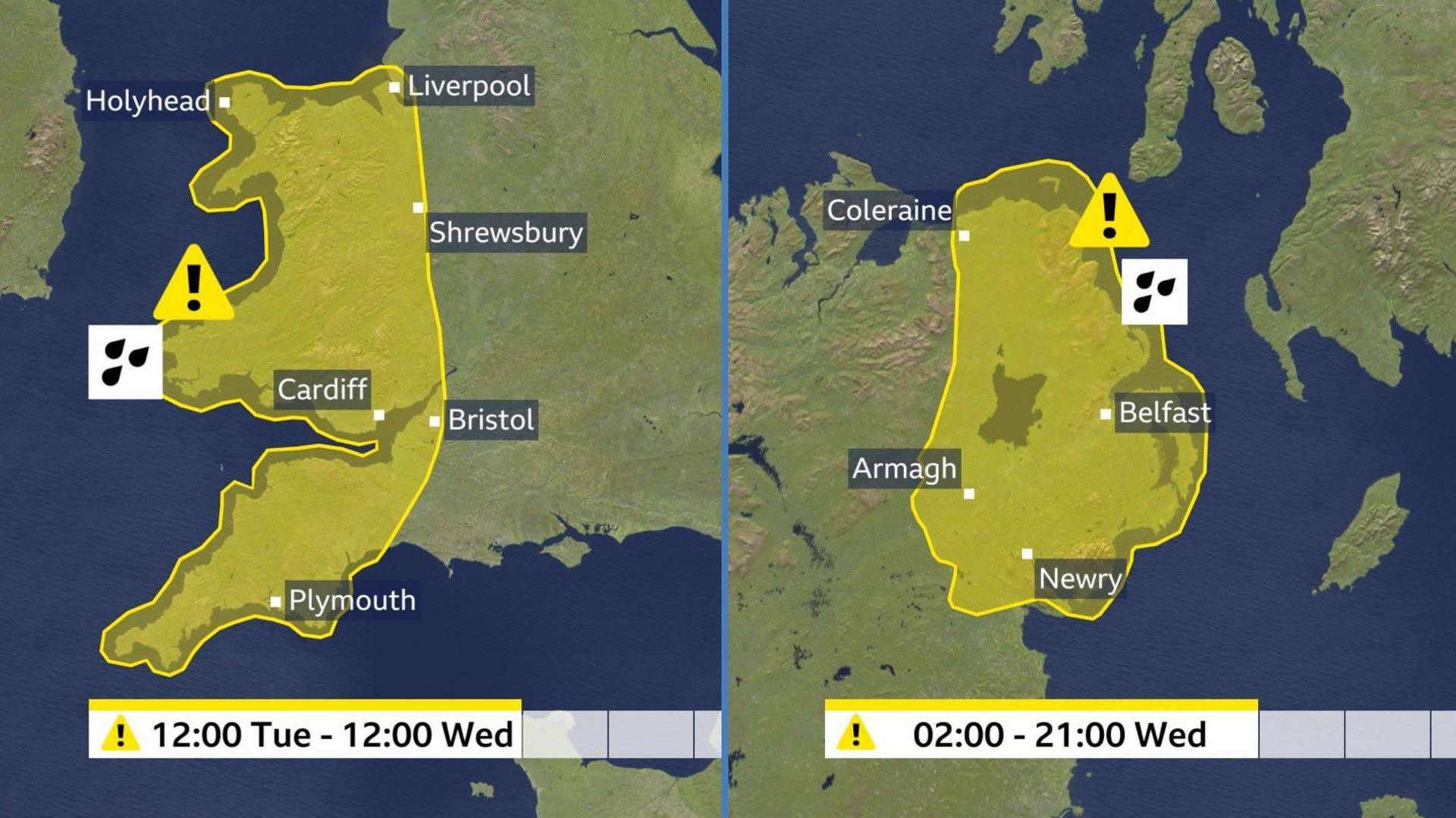

The Met Office has issued yellow warnings for rain across parts of the UK.
Wales, western England and Northern Ireland are set to be worst affected with the risk of localised flooding and travel disruption on Tuesday and Wednesday.
Showers and thunderstorms are expected more widely across the UK and strong winds will also be a feature.
It marks a big change from the exceptionally dry, warm and sunny weather that has dominated for the first half of this month.
However, it does not necessarily spell a washout Easter weekend with signs of a few drier interludes between the April showers.
A slow-moving band of heavy rain will affect south-west England and Wales - along with parts of the West Midlands and north-west England - during Tuesday.
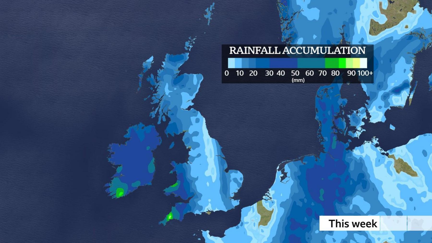
Around 20-40mm (0.8-1.6in) of rain will fall widely across this area with the wettest locations seeing 75mm (3in).
Some thunderstorms are also expected within the heaviest downpours.

The zone of wet weather will then shift towards Northern Ireland by Wednesday where 20-30mm (0.8-1.2in) of rain is expected to fall in many locations.
Some hills in Antrim and Down could see up to 60mm (2.4in).
The Met Office warns that this could bring flooding in a few places as well as localised disruption to road and rail travel.
The worst of the rain is expected to clear during Wednesday night.
In those parts of the UK that are not covered by weather warnings the forecast is more mixed.
There will be some heavy, thundery showers but with sunny spells in between.

A swathe of strong and gusty winds is also expected to move northwards during Tuesday night and Wednesday - particularly affecting England, Wales and parts of Northern Ireland.
Some southern coasts, as well as the Channel Islands, could briefly see gales.
Daytime highs over the next few days will tend to be around 10-17C (50-63F).
These temperatures are lower than we have seen lately but still around the average for mid-April.
Overnight temperatures will vary depending on cloud cover but some pockets of frost are still likely, particularly in the northern half of the UK.
The first half of April was exceptionally dry.
In fact some parts of southern and eastern England had no measurable rain for over three weeks because of what we call a blocked weather pattern.
The jet stream was effectively locked in place to the north of the UK, steering rain-bearing weather systems away and allowing high pressure to dominate.

That has now changed drastically.
The jet stream has repositioned itself much further south, trapping low pressure overhead and bringing spells of heavy rain.
Computer weather models have been struggling to make up their minds about the prospects for the Easter weekend.
At the moment it looks like low pressure will approach from the west on Good Friday bringing outbreaks of heavy rain, especially in western parts.
However, it is possible that some eastern areas may stay largely dry.
The rest of the weekend is likely to be mixed with low pressure and high pressure battling for dominance.
Some downpours are likely but there should also be drier interludes and spells of sunshine.
So while it looks unlikely that we will return to the completely dry conditions of early April it does not look like a complete washout either.
If you are making plans for Easter you can always keep up to date with the forecast on the BBC Weather website and app.